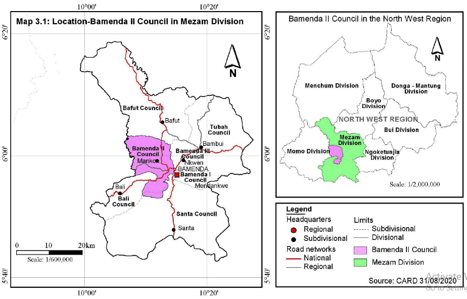
The Bamenda II Council area is delineated by the Bamenda II Sub-division, one of the 7 administrative units (Sub-divisions) of Mezam Division in the North West Region of Cameroon. It lies between latitudes 5°52'52" and 6°4'03" north of the equator and longitudes 10°2'02" and 10°10'10" east of the Greenwich meridian. This council area is bordered by six councils, Bafut to the North, Bamenda III and Bamenda I Councils to the East, Santa Council to the South and then Bali and Mbengwi Councils to the West.
The surface area of Bamenda II Council is estimated at 1,482km2 with a projected population of 261,285 persons in 2019, the population density is approximately 176.3persons/km2. The urban area is densely populated and the density decreases towards the urban periphery and rural areas. The high density is associated with the concentration of administrative, health and educational and socio-economic institutions.
Location of Bamenda II Council within Cameroon/North West Region